
Abernathy HPC Campus
Project of TeraWulf
Where it stands
TeraWulf sold its entire 50.1% interest in the Abernathy Joint Venture, which owns the Abernathy HPC Campus, to a Fluidstack-led investor group effective July 6, 2026, for about $530 million paid in installments. An analyst report refers to the campus as a 168 MW program. None of the passages say how much capacity at the campus is operating or under construction, so the MW fields reflect only that program size.
168 MW planned
Assessed October 18, 2026 from the newest filings, releases and reporting that name this project (newest relied on: September 16, 2026).
Capacity
What has actually been delivered, against what has been promised. Each figure links to the statement it came from.
| Stage | Capacity | As of | Source |
|---|---|---|---|
| Energized power flowing today | -- | ||
| Contracted a customer is on the hook | 168 MW | 2026-10-06 | Fluidstack 168 MW lease at Abernathy JV |
| Under construction | -- | ||
| Permitted | -- | ||
| Interconnect approved utility has agreed to deliver | -- | ||
| Interconnect requested in a queue, nothing approved | -- | ||
| Announced a press-release figure | 240 MW | 2025-11-09 | Abernathy Campus initial and expansion capacity |
Who has claimed this site
Capacity commitments in the order they were announced. A commitment that ended shows why.
Claims about this project
Site intelligence

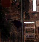


How we located this site
- Initial geocode 2026-09-05
Abernathy, Texas, TX → town/county centre, 4 km box -- not the site - Starting point (the project's stated locality) 2026-10-19
Abernathy, Texas → 33.83230, -101.84295 (locality) - No site-level evidence yet 2026-10-19
no address, road, landmark or coordinates tie this project to a specific parcel yet -- the town is shown, NOT the site - OpenStreetMap features nearby 2026-10-19
0 named match(es)
- 2022-04-15 vs 2022-03-06: new roof or pavement visible
- 2022-09-30 vs 2022-08-30: structural change (radar signal shift)
- 2022-08-30 vs 2022-08-01: structural change (radar signal shift)
- 2023-06-26 vs 2023-05-28: structural change (radar signal shift)
- 2023-05-28 vs 2023-04-27: structural change (radar signal shift)
Satellite imagery on this page is drawn from the Google Earth satellite basemap, USDA NAIP aerial photography (~1 m/pixel), ESA Sentinel-2 multispectral (10 m, with per-date cloud masks), NASA / USGS Landsat 8/9 (30 m, plus surface temperature), ESA Sentinel-1 radar (all-weather, night), NASA ECOSTRESS thermal (~70 m), and NASA Black Marble night lights (500 m, daily). Each image is dated, labelled by source and pixel resolution, and downloadable at its native size; cloudy dates are kept and marked rather than hidden. New scenes are pulled daily as each provider publishes them.