jain.com

Muskogee

Project of Core Scientific

Kind
datacenter
Location
Muskogee, Oklahoma
County
Muskogee County
State/region
OK
Country
US
Status
under construction as of August 31, 2026

Where it stands

Core Scientific plans to scale its Muskogee, Oklahoma campus to about 1.5 GW gross (about 1.0 GW leasable) and closed the $444M Polaris DS acquisition on August 14, 2026, securing about 440 MW of grid-connected power under OG&E agreements. A 70 MW facility leased for NVIDIA GB300 was reported in final testing and expected to become operational in Q2 2026, but no passage confirms it entered service. The next 82-82.5 MW delivery is dated H2 2027 in one passage and Q4 2027 in another, and the 440 MW is power capacity rather than leased data-center capacity, so operating MW is left null.

1,500 MW planned

PhaseMWStatusDateSource
70 MW GB300 facility (existing tenant)70ready for servicethe Muskogee campus already has one active tenant, with a 70 MW facility leased and built to support NVIDIA’s GB300 platform
2026-08-18 View cached copy (2026-08-31)Live source ↗
Polaris DS acquisition (grid power)440planned2026-08-14Core Scientific completed its Polaris DS acquisition on August 14, adding about 440 megawatts of grid-connected power capacity for roughly $444 million in cash
2026-08-20 View cached copy (2026-08-31)Live source ↗
Initial expansion building82.5plannedAn initial 82.5 MW building is slated for delivery in Q4 2027.
2026-08-19 View cached copy (2026-08-31)Live source ↗

Assessed October 18, 2026 from the newest filings, releases and reporting that name this project (newest relied on: August 31, 2026).

Capacity

What has actually been delivered, against what has been promised. Each figure links to the statement it came from.

StageCapacityAs ofSource
Energized power flowing today100 MW2026-03-01Muskogee, Oklahoma facility
Contracted a customer is on the hook440 MW2026-09-26Muskogee, OK Expansion Capacity Post-Polaris
Under construction100 MW2026-09-01Muskogee OK facility capacity in development
Permitted--
Interconnect approved utility has agreed to deliver--
Interconnect requested in a queue, nothing approved--
Announced a press-release figure1,500 MW2026-08-31Muskogee campus power expansion

Who has claimed this site

Capacity commitments in the order they were announced. A commitment that ended shows why.

2025-10-30
CoreWeave - tenant · 440 MW · 12-year term source
2026-07-27
Advanced Micro Devices - tenant · 15-year term source

Claims about this project

2022-03-29 - stated
2022-03-29 - stated
2022-05-12 - stated
2022-09-07 - stated
2023-04-03 - stated
2024-08-07 - stated
2024-08-07 - stated
2025-05-06 - stated
2025-05-07 - stated
2025-10-29 - stated
2025-10-30 - stated
2025-10-30 - stated
2026-03-01 - stated
2026-05-05 - stated
2026-05-05 - stated
2026-05-05 - stated
Contingent acquisition payment 40.0 USD. Promised by 2026-12-31.
2026-05-05 - stated
2026-05-05 - verified
2026-05-05 - stated
2026-05-05 - verified
2026-05-05 - stated
2026-05-06 - verified
Muskogee, OK CoreWeave facility delivery 70.0 MW. Promised by 2026-06-30.
2026-05-06 - stated
Muskogee, OK Expansion Capacity Post-Polaris 440.0 MW. Promised by 2027-12-31.
2026-05-06 - stated
2026-05-06 - outcome unconfirmed
Muskogee, OK ~70 MW delivery 70.0 MW. Promised by 2026-06-30.
2026-05-06 - stated
Muskogee Polaris initial power delivery 440.0 MW. Promised by 2027-12-31.
2026-05-06 - stated
Polaris Muskogee power delivery. Promised by 2027-10-31.
2026-07-27 - stated
AMD Muskogee OK initial delivery. Promised by 2027-12-31.
2026-07-28 - stated
2026-07-28 - stated
Muskogee OK site delivery. Promised by 2027-12-31.
2026-07-28 - stated
Muskogee, OK initial delivery 2H 2027. Promised by 2027-12-31.
2026-08-13 - stated
Contingent capacity-based earnout 40.0 MW. Promised by 2026-12-31.
2026-08-13 - stated
2026-08-14 - stated
2026-08-14 - stated
2026-08-14 - stated
82 MW delivery at Muskogee in H2 2027 82.0 MW. Promised by 2027-07-01.
2026-08-14 - stated
2026-08-14 - verified
2026-08-14 - stated
82 MW delivery to customer in H2 2027 82.0 MW. Promised by 2027-12-31.
2026-08-14 - stated
2026-08-14 - stated
2026-08-15 - stated
2026-08-15 - stated
2026-08-15 - stated
2026-08-18 - stated
2026-08-18 - outcome unconfirmed
70 MW NVIDIA GB300 facility at Muskogee 70.0 MW. Promised by 2026-06-30.
2026-08-19 - stated
2026-08-31 - stated

Site intelligence

Analytical estimate. Each site below is located from public records (filings, releases, news, OpenStreetMap) and checked against free satellite imagery; "How we located this site" lists every step and the score it earned. The conclusion is computed from night-time lights, surface heat and year-over-year change, with the dates it rests on. These are hypotheses under active tracking, not legal parcels or an official endorsement.
1525 W SMITH FERRY RD, MUSKOGEE, OK, 74401
Candidate
Muskogee County, OK
35.6970, -95.3845
Approximate address 1431 W 43rd St S, Muskogee, OK 74401, USA Reverse-geocoded from the candidate centroid; not a permit-confirmed parcel address.
Conclusion so far Operating: the site is lit at night like a running facility. · confidence 75%
Running: night-time lights at the site ran 10.92x the surrounding area (7 of 7 clear nights, 2026-09-15 to 2026-10-03); surface temperature +0.5 K against its surroundings (10 pass(es), 2026-09-19 to 2026-10-13). Based on 34 clear observation(s) from 2026-06-21 to 2026-10-19.
What would change this: Lights going dark over several clear nights.
Latest clear imagery: Google 2026-10-18 · Sentinel-2 2026-10-17 · ECOSTRESS thermal 2026-10-13 · Landsat 2026-10-07 · radar 2026-10-07 · night lights 2026-10-03 · NAIP 2023-10-13
Newest clear images166 clear image date(s)
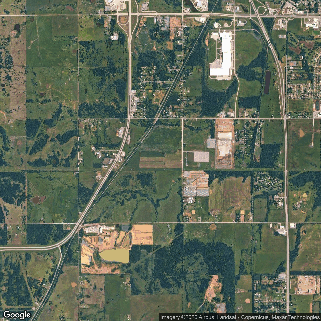
Visual view of core-scientific-muskogee, 2026-10-18 (Google Earth (wide view))
2026-10-18Google Earth (wide view) · 3.88 m/pixel
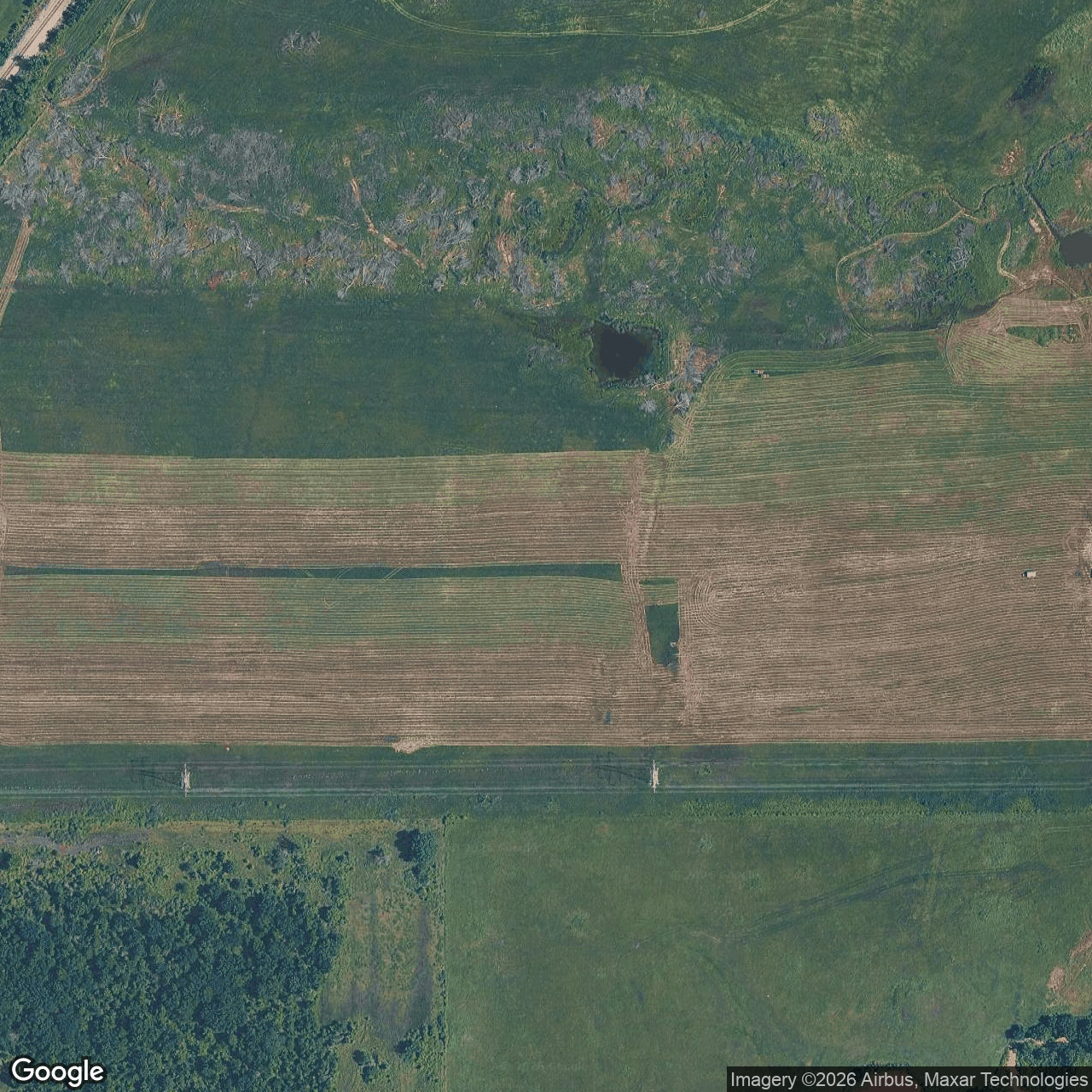
Visual view of core-scientific-muskogee, 2026-10-18 (Google Earth (close view))
2026-10-18Google Earth (close view) · 0.49 m/pixel
Visual view of core-scientific-muskogee, 2026-10-17 (Sentinel-2)
2026-10-17Sentinel-2 · 10 m/pixel
Thermal view of core-scientific-muskogee, 2026-10-13 (ECOSTRESS thermal)
2026-10-13ECOSTRESS thermal · 70 m/pixel
How we located this site
35/100 (candidate): street location 25 + 1 independent source family 10
  1. Starting point (the project's stated locality) 2026-10-19
    Muskogee, Oklahoma → 35.74788, -95.36969 (locality)
  2. Located from a published address 2026-10-19
    1525 W. Smith Ferry Road → 35.69695, -95.38449 (street), 5.8 km from seed
  3. OpenStreetMap features nearby 2026-10-19
    0 named match(es)
Recent changes
  • 2023-12-10 vs 2023-10-14: vegetation recovery visible
  • 2024-04-07 vs 2024-02-20: vegetation recovery visible
  • 2025-05-20 vs 2025-04-10: vegetation recovery visible
  • 2025-05-20 vs 2025-04-10: vegetation recovery visible

Satellite imagery on this page is drawn from the Google Earth satellite basemap, USDA NAIP aerial photography (~1 m/pixel), ESA Sentinel-2 multispectral (10 m, with per-date cloud masks), NASA / USGS Landsat 8/9 (30 m, plus surface temperature), ESA Sentinel-1 radar (all-weather, night), NASA ECOSTRESS thermal (~70 m), and NASA Black Marble night lights (500 m, daily). Each image is dated, labelled by source and pixel resolution, and downloadable at its native size; cloudy dates are kept and marked rather than hidden. New scenes are pulled daily as each provider publishes them.