
Camp Pendleton
Project of CleanSpark
Where it stands
CleanSpark's Camp Pendleton work covers two microgrids on the base: the 1.1MW FractalGrid demonstration facility and a $900,000 turn-key microgrid for the Navy's CIS operations complex. The FractalGrid assets were fully impaired in FY2017 pending release to USMC Camp Pendleton. The CIS microgrid was completed and accepted by the government in May 2019. Later filings (2025-2026) mention Camp Pendleton only as historical work before CleanSpark's pivot to bitcoin mining, so current physical operation and ownership after 2019 are not confirmed. The 1.1MW figure applies only to the FractalGrid; no MW is stated for the CIS microgrid.
1 MW in service
| Phase | MW | Status | Date | Source |
|---|---|---|---|---|
| FractalGrid Demonstration Facility (School of Infantry, 52 Area) | 1.1 | operational | The mPulse software has proven to be robust and reliable, operating successfully at the Camp Pendleton FractalGrid installation continuously for over 3 years with minimal maintenance and support required. 2018-08-19 View cached copy (2026-09-13)Live source ↗ | |
| CIS operations complex microgrid (Bethel-Webcor JV subcontract) | operational | 2019-05-02 | The Company began on-site work for this project in February of 2018 and completed its scope of work in May 2019. 2019-05-14 View cached copy (2026-09-13)Live source ↗ |
Assessed November 1, 2026 from the newest filings, releases and reporting that name this project (newest relied on: May 14, 2019).
Capacity
What has actually been delivered, against what has been promised. Each figure links to the statement it came from.
| Stage | Capacity | As of | Source |
|---|---|---|---|
| Energized power flowing today | 1.1 MW | 2019-01-14 | Camp Pendleton FractalGrid capacity |
| Contracted a customer is on the hook | -- | ||
| Under construction | 1.1 MW | 2019-01-14 | Camp Pendleton FractalGrid 1.1MW capacity |
| Permitted | -- | ||
| Interconnect approved utility has agreed to deliver | -- | ||
| Interconnect requested in a queue, nothing approved | -- | ||
| Announced a press-release figure | 1.1 MW | 2019-01-14 | Camp Pendleton FractalGrid capacity |
Who has claimed this site
Capacity commitments in the order they were announced. A commitment that ended shows why.
Claims about this project
Site intelligence


How we located this site
- Starting point (the project's stated locality) 2026-11-01
Camp Pendleton, California → 33.21455, -117.38715 (locality) - Rejected facts that point elsewhere 2026-11-01
4 fact(s) rejected
1366 Skyline Dr., Bountiful, UT 84010 (984.8 km away); 3236 North Pelican Dr., Farr West, UT 84404 (1017.7 km away); 4360 Viewridge Avenue (50.1 km away); 6365 Nancy Ridge Drive (41.0 km away) - Located from a published address 2026-11-01
FractalGrid Demonstration Facility, Camp Pendleton Marine Corp Base → 33.30826, -117.30978 (street), 12.7 km from seed - OpenStreetMap features nearby 2026-11-01
0 named match(es)
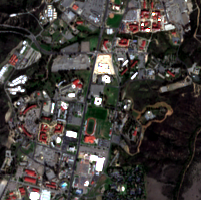
Satellite imagery on this page is drawn from the Google Earth satellite basemap, USDA NAIP aerial photography (~1 m/pixel), ESA Sentinel-2 multispectral (10 m, with per-date cloud masks), NASA / USGS Landsat 8/9 (30 m, plus surface temperature), ESA Sentinel-1 radar (all-weather, night), NASA ECOSTRESS thermal (~70 m), and NASA Black Marble night lights (500 m, daily). Each image is dated, labelled by source and pixel resolution, and downloadable at its native size; cloudy dates are kept and marked rather than hidden. New scenes are pulled daily as each provider publishes them.