
Commerce Drive
Project of Riot
Capacity
What has actually been delivered, against what has been promised. Each figure links to the statement it came from.
| Stage | Capacity | As of | Source |
|---|---|---|---|
| Energized power flowing today | -- | ||
| Contracted a customer is on the hook | 60 MW | 2024-07-22 | Commerce Drive expansion potential |
| Under construction | -- | ||
| Permitted | -- | ||
| Interconnect approved utility has agreed to deliver | -- | ||
| Interconnect requested in a queue, nothing approved | -- | ||
| Announced a press-release figure | 40 MW | 2024-07-22 | Commerce Drive 40 MW expansion |
Claims about this project
2024-07-22 - delayed
2024-07-22 - outcome unconfirmed
2024-07-22 - stated
Commerce Drive expansion potential 60.0 MW.
2024-07-30 - stated
Site intelligence
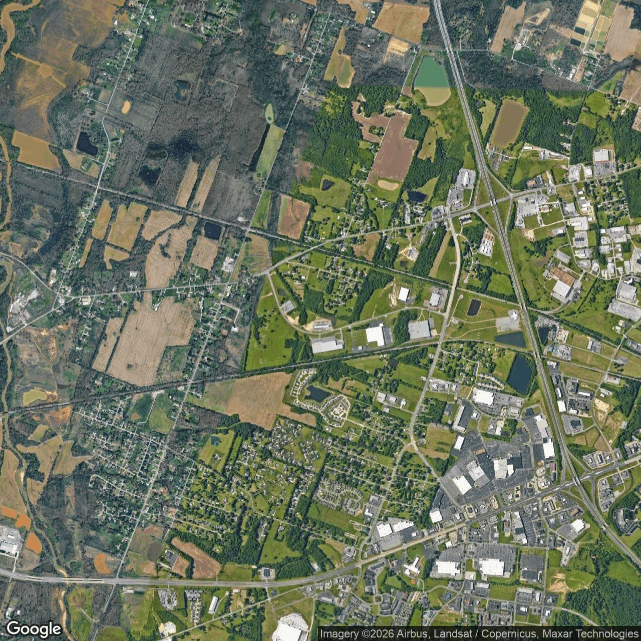
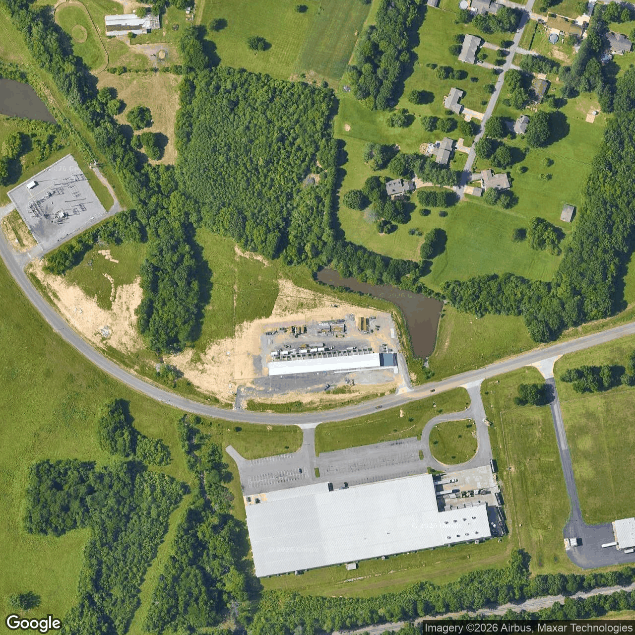
Analytical estimate. Each site below is located from public records (filings, releases, news, OpenStreetMap) and checked against free satellite imagery; "How we located this site" lists every step and the score it earned. The conclusion is computed from night-time lights, surface heat and year-over-year change, with the dates it rests on. These are hypotheses under active tracking, not legal parcels or an official endorsement.
Riot Kentucky
Probable McCracken County, KY
37.0891, -88.7029
Approximate address 5657 Commerce Dr, Paducah, KY 42001, USA Reverse-geocoded from the candidate centroid; not a permit-confirmed parcel address.
Conclusion so far Operating: the site is lit at night like a running facility. · confidence 75%
Running: night-time lights at the site ran 3.97x the surrounding area (4 of 4 clear nights, 2026-10-07 to 2026-10-19); surface temperature +0.3 K against its surroundings (6 pass(es), 2026-10-03 to 2026-10-27). Based on 23 clear observation(s) from 2026-07-05 to 2026-11-02.
What would change this: Lights going dark over several clear nights.
Latest clear imagery: Google 2026-11-02 · Landsat 2026-10-27 · radar 2026-10-27 · ECOSTRESS thermal 2026-10-25 · Sentinel-2 2026-10-21 · night lights 2026-10-19 · NAIP 2022-06-29
Newest clear images17 clear image date(s)


How we located this site
40/100 (probable): footprint location 40
- Starting point (the project's stated locality) 2026-11-02
Paducah, Kentucky → 37.08417, -88.59803 (locality) - OpenStreetMap feature named for the project 2026-11-02
Riot Kentucky → 37.08913, -88.70292, 9.3 km from the locality seed - OpenStreetMap features nearby 2026-11-02
1 named match(es)
Recent changes
- 2026-10-11 vs 2026-10-03: vegetation recovery visible — Between scenes 8 days apart, NDVI increased by 0.178 and NDWI decreased by 0.166, consistent with vegetation recovery, though a concurrent NDBI increase of 0.074 and the short interval make this a mixed signal.
Satellite imagery on this page is drawn from the Google Earth satellite basemap, USDA NAIP aerial photography (~1 m/pixel), ESA Sentinel-2 multispectral (10 m, with per-date cloud masks), NASA / USGS Landsat 8/9 (30 m, plus surface temperature), ESA Sentinel-1 radar (all-weather, night), NASA ECOSTRESS thermal (~70 m), and NASA Black Marble night lights (500 m, daily). Each image is dated, labelled by source and pixel resolution, and downloadable at its native size; cloudy dates are kept and marked rather than hidden. New scenes are pulled daily as each provider publishes them.